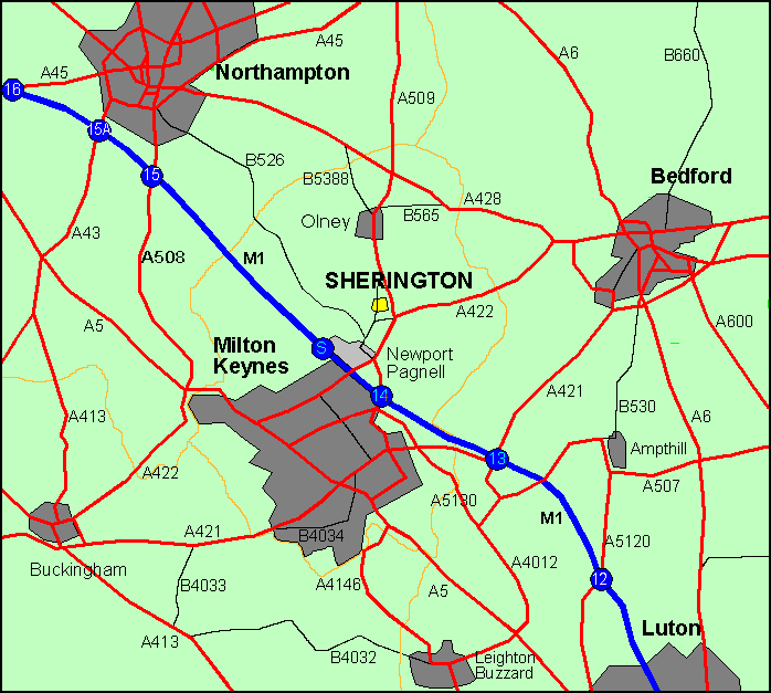
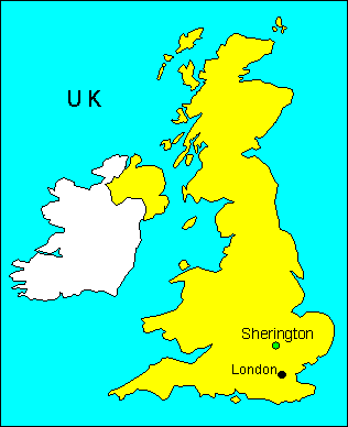
Where is Sherington?
- Sherington is situated in the pleasant countryside of North Buckinghamshire, next to the River Great Ouse, yet is only 7 miles from the centre of the New City of Milton Keynes to which it is linked by good dual carriageway roads.
- Newport Pagnell (famous for Aston Martin Lagonda cars and the motorway service station) is 2 miles SW, whilst Olney (famous for its Pancake Race on Shrove Tuesday and where William Cowper lived) is 3 miles N.
- The village is 3 miles NE of Junction 14 of the M1 motorway, approximately 50 miles north of London.
- Bedford is 13 miles to the east along the A422.
- The neighbouring villages are Lathbury, Tyringham, Filgrave, Emberton and Chicheley.
- The Ordnance Survey grid reference is SP 890 465.
Regional Map